


Files
Download Full Text (567 KB)
Description
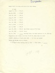
A list of water level data "for maps and photos" on specific dates, for Trempealeau, Wisconsin. 1 page. Part of the Cal R. Fremling Collection.
Publication Date
1940
Item Type
Book
Publisher
Library
City
Winona, Minnesota
Keywords
Biologists; Mississippi River; Trempealeau (Wis.); Trempealeau, Wisconsin
Department
Special Collections-Library
Recommended Citation
Fremling, Cal R., "Trempealeau water levels for aerial photos" (1940). Cal Fremling Papers. 97.
https://openriver.winona.edu/calfremlingpapers/97
Rights Management
Requests to reproduce this image must be granted by the Winona County Historical Society.
Contributing Institution
Winona County History Center
Physical Format
Document
Master File Format
Fiscal Sponsor
This project has been financed in part with funds provided by the State of Minnesota from the Arts and Cultural Heritage Fund through the Minnesota Historical Society.
Scanning Responsibility
Winona State University
Date Digital
2019-07-24 00:00
Metadata Creation Responsibility
Anna Gaffey
Unique Identifier
2011.003.0197

Notes
1940-1969